
As-Built Surveys & Scan-to-BIM for Renovation and Design Teams
We laser-scan your building with a Leica BLK and deliver clean 2D CAD drawings or a working Revit model of the space as it actually exists today — so design decisions are based on real measurements, not outdated drawings.
One scan. A complete documentation set.
Point Cloud Data
A full 3D laser scan of the building, capturing every wall, column, ceiling height, and opening exactly as it exists today.
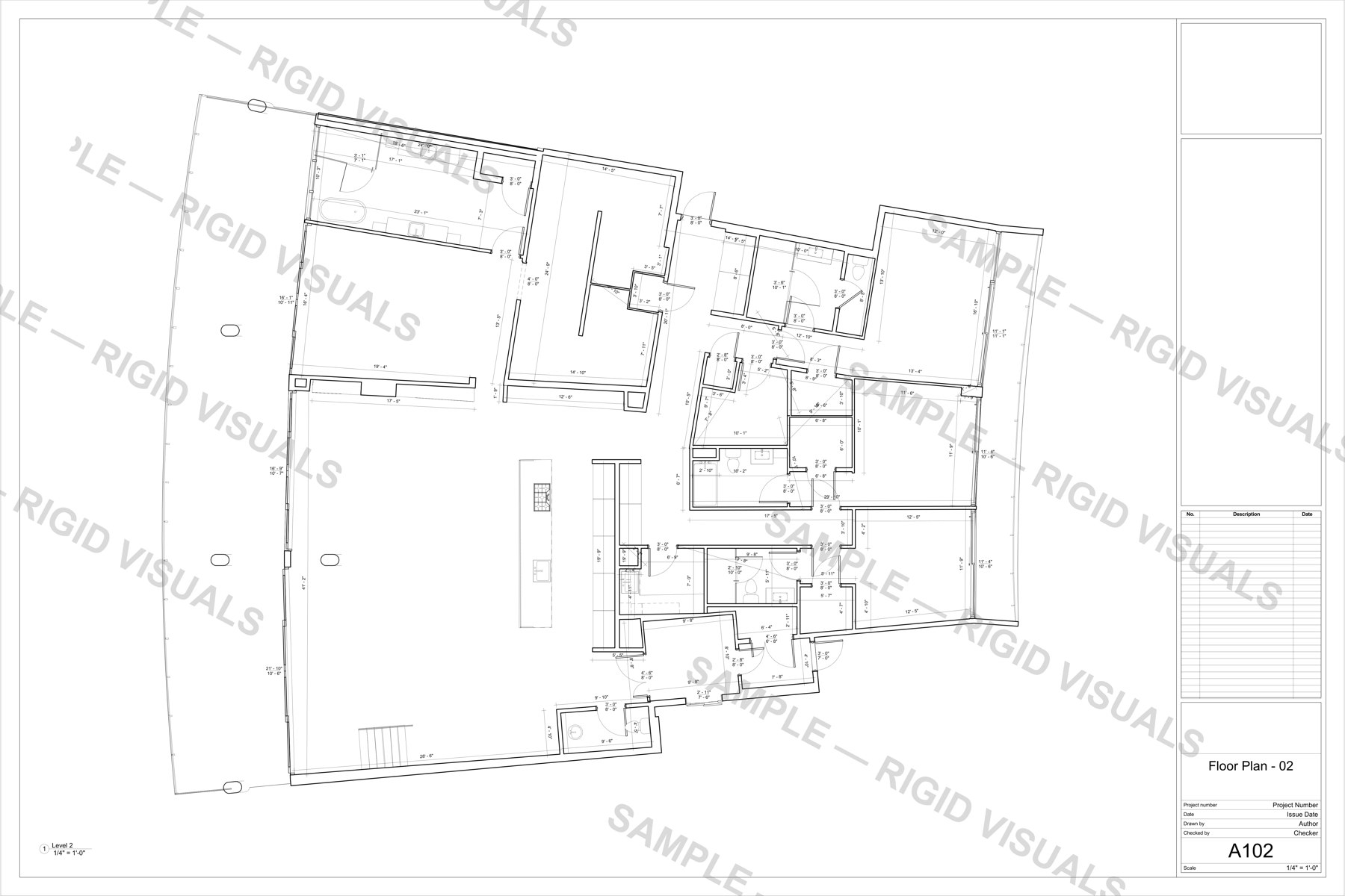
2D CAD Drawings
Clean, dimensioned DWG floor plans and elevations, delivered ready to drop into your existing CAD workflow.
Revit (BIM) Model
A working Revit model built directly from the scan data — not traced over an old drawing set — ready for design, coordination, and clash detection.
Field Measurements
Verified dimensions and existing-conditions documentation your team can reference without re-measuring the building by hand.
Raw scan data as little as 48 hours after capture.
The point cloud is processed and available fast. Full CAD or Revit modeling timelines depend on the building's size and complexity — we'll give you a specific date on the intro call before work starts, not a generic promise.
A complete project, not a mockup.
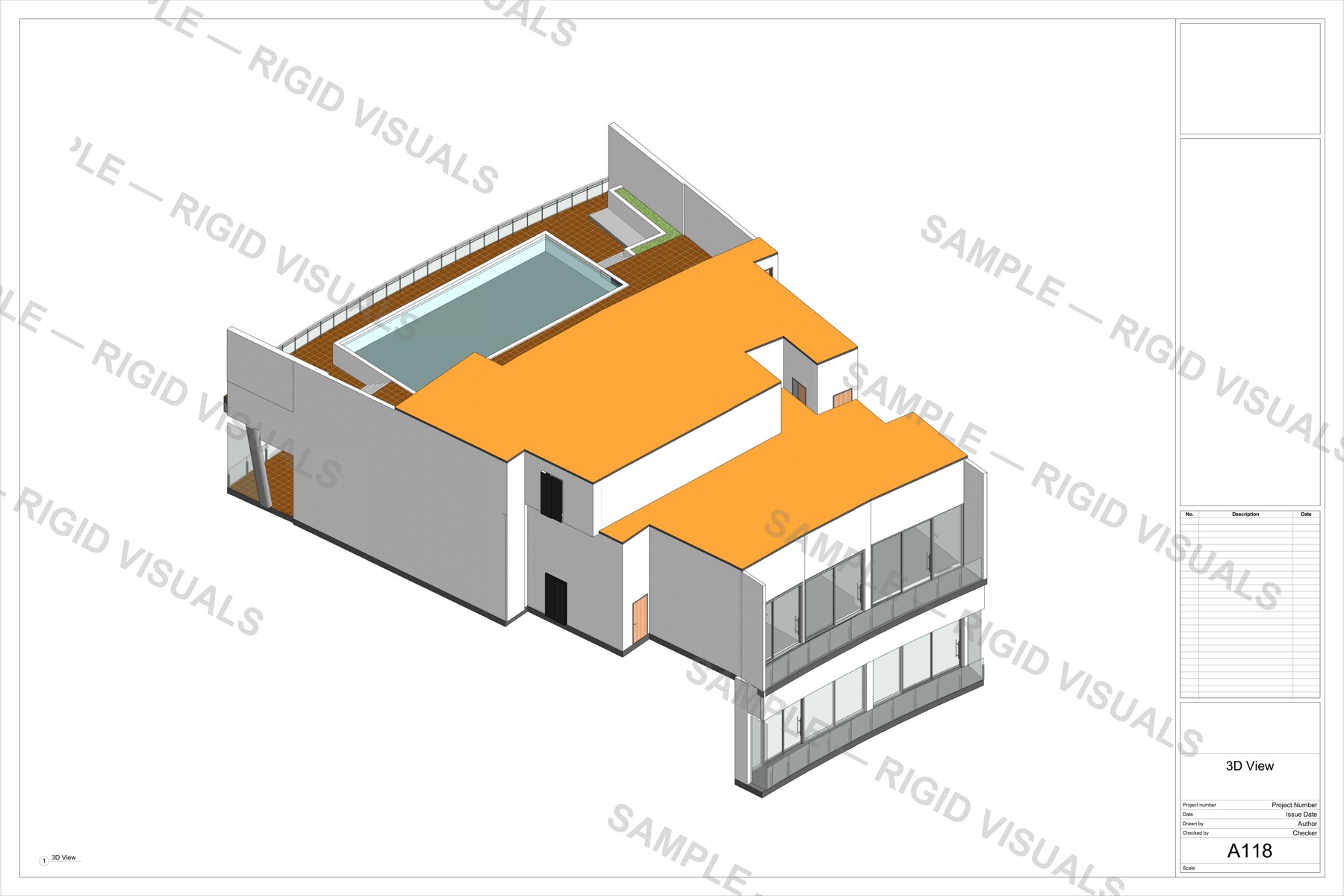
From the JEID Studio project — full technical documentation package for a design/engineering firm's client project — laser scan, BIM, MEP, floor plans, elevations, and measurements delivered as one engagement.
JEID Studio
Full technical documentation package for a design/engineering firm's client project — laser scan, BIM, MEP, floor plans, elevations, and measurements delivered as one engagement.
Our Process
From the first call to a finished Revit model or CAD set, one team scans, models, and delivers the project — nothing handed off partway through.
The First Call
You'll spend 20–30 minutes on a call directly with the team doing the work, not a salesperson. We'll talk through your building, your timeline, and what you actually need at the end. If it's not a fit, you'll hear that on the call.
Onsite Capture
We plan the visit around how your building runs — after hours for retail, around tenants for occupied buildings. You'll know exactly who's on site and when.
Processing
Once we leave site, your data is processed and checked before anything goes out. You're not the quality control.
Delivery
You get your files in whatever format you actually work in — Matterport link, CAD, Revit, or straight video/photo files — plus a quick handoff call so nothing gets lost.
Industries
Commercial Real Estate
Get accurate existing-conditions drawings before pricing a renovation or tenant improvement — not a guess based on decades-old plans.
Architecture & Engineering Firms
Skip the manual measure-and-trace process — start design work from a field-verified Revit model or CAD set instead.
Developers & General Contractors
Base pricing and scheduling on as-built conditions instead of discovering discrepancies mid-construction.
Property & Facilities Management
Keep an accurate record of a building's actual layout for future renovation, leasing, or maintenance planning.
Insurance
Document a building's existing structural conditions with verified, scan-based measurements — a defensible baseline record instead of a disputed description.
Multifamily
Get accurate unit and common-area floor plans for renovation planning or updated leasing materials, without re-measuring every unit by hand.
Related Services
Matterport Virtual Tours
Want a walkable 3D tour too, not just CAD/Revit files? See Matterport Virtual Tours.
Commercial Photography
Add professional photography to complement your as-built documentation package.
Aerial / Drone Mapping
Add aerial site context — elevation data or an orthomosaic — to round out the documentation package.
What Clients Say
“Their attention to detail on aerial mapping work is unmatched — exactly the standard a construction timeline needs.”JOHN D. — CONSTRUCTION MANAGER
“An exceptional partner we trust to extend service to our own clients across South & Central Florida.”FRANK M. — ENVISIA360
FAQ
What's the difference between a CAD drawing and a BIM (Revit) model?+
A CAD drawing (DWG) is a flat 2D floor plan or elevation. A BIM model is a working 3D Revit file with real geometry, useful for design coordination and clash detection — not just a picture of a floor plan.
How accurate is the scan data?+
We use a Leica BLK for these jobs — professional survey-grade equipment — so laser scanning is a highly precise capture method. That said, exact tolerances still depend on the specific scanner setup and building conditions, so we'll walk through what's achievable for your project on the intro call rather than quote a blanket number.
How long does modeling take after the scan?+
It depends on the building's size and complexity. Raw scan data is available fast — full CAD or Revit modeling timelines are scoped on the intro call once we know the project.
What file formats do I receive?+
Revit (.rvt), DWG, and PDF — whatever combination fits your workflow. Most projects get all three: a working BIM model, a CAD drawing set, and PDFs for easy review and markup.
Can you scan an occupied building?+
Yes — we plan the scan around your building's schedule, same as any other capture, so it doesn't disrupt tenants or daily operations.
Do you also document MEP systems as part of this?+
Dedicated, coordinated MEP engineering isn't something we offer as a standalone scope. That said, MEP documentation is naturally a byproduct of the scan-to-BIM process — visible mechanical, electrical, and plumbing elements get captured and modeled as part of the building's overall geometry, even though full MEP coordination and clash detection aren't in scope.
Do you cover projects outside South Florida?+
Yes — we're headquartered in Miami but scan nationwide and internationally, with projects across 23 states and 19 countries to date.