
Commercial Real Estate
Give brokers and landlords a listing that sells itself — walkable tours, aerial photos, and portfolio photography prospects can review without another showing.
Listing tours & photography →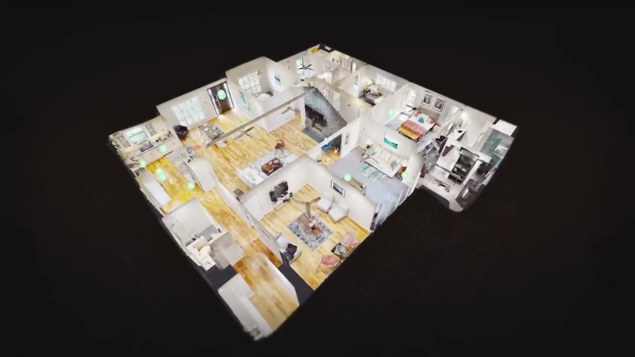
Matterport tours, drone mapping, commercial photography, and scan-to-BIM for commercial real estate, architecture, and engineering firms. The team that scopes your project is the team that delivers it.
Reply within one business day, from the team doing the work.
Direct technicians in Miami, Ft. Lauderdale, Memphis, Austin, Cancún, Medellín, and Panama City. Crews work in English and Spanish.
No account managers, no relayed messages, no subcontracted crew you've never spoken to. Whether it's a single Matterport tour or a full as-built survey, the same team that scoped the call is accountable for what gets delivered — start to finish.
From a single Matterport tour to a full as-built survey package — captured and delivered by the same team you booked the call with.
A walkable 3D model of your property anyone on your team can explore from a browser — no site visit required.
Orthomosaic maps, elevation data, aerial photography, and drone video for site monitoring, marketing, and pre-construction planning.
Clean, consistent property photography for listings, marketing, and condition documentation.
Laser scan data turned into accurate floor plans, CAD drawings, and Revit models — no guessing what's on site.
A live Matterport tour from a Memphis, TN project — a fully walkable Matterport tour of an abandoned 4-story, 100,000 sq ft parking garage, letting an out-of-state ownership group get contractor repair estimates without anyone flying to Memphis.























Logos are trademarks of their respective owners.
From the first call to final delivery, one small team handles every step — no handoffs, no surprises.
You'll spend 20–30 minutes on a call directly with the team doing the work, not a salesperson. We'll talk through your building, your timeline, and what you actually need at the end. If it's not a fit, you'll hear that on the call.
We plan the visit around how your building runs — after hours for retail, around tenants for occupied buildings. You'll know exactly who's on site and when.
Once we leave site, your data is processed and checked before anything goes out. You're not the quality control.
You get your files in whatever format you actually work in — Matterport link, CAD, Revit, or straight video/photo files — plus a quick handoff call so nothing gets lost.
Give brokers and landlords a listing that sells itself — walkable tours, aerial photos, and portfolio photography prospects can review without another showing.
Listing tours & photography →Skip the manual measure-and-trace process — start design work from a field-verified Revit model, CAD set, or scanned 3D reference instead of a drawing set that stopped matching the building years ago.
As-builts, CAD & Revit →Base pricing and scheduling on as-built conditions, and track progress with a repeatable drone flight path — not a guess from an outdated plan set.
Site mapping & progress flights →Keep a living visual record of every property in a portfolio — pulled up for insurance, maintenance planning, or a new hire's first walk of the building.
Portfolio tours & floor plans →Give adjusters and property owners a fast, verified 3D record of a property's condition — pre-loss or post-loss — that reduces disputes and speeds settlements.
Condition records →Turn vacant units into tours prospects can walk at 11pm from their couch — the highest-leverage leasing tool a property manager can add without touching the unit.
Unit tours for leasing →“Their attention to detail on aerial mapping work is unmatched — exactly the standard a construction timeline needs.”JOHN D. — CONSTRUCTION MANAGER
“An exceptional partner we trust to extend service to our own clients across South & Central Florida.”FRANK M. — ENVISIA360
Reply within one business day, from the team doing the work.