
Aerial Drone Mapping, Photography & Video for Commercial Properties
We fly a DJI Mavic 3 Enterprise to capture grid-flown orthomosaic maps, high-resolution aerial photography, and drone video — flown by an FAA-certified pilot and delivered fast enough to keep your project, or your marketing, on schedule.
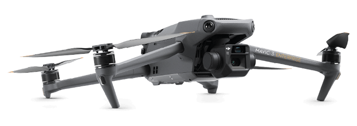
One flight, three capture types.
Orthomosaic Maps
A single, geographically accurate stitched map built from a programmed grid flight — the same format surveyors and planners use to measure and mark up. The same flight path is repeatable for progress tracking over time.
Elevation & Topographic Data
Point cloud and elevation models generated from the same flight data — useful for grading, drainage planning, and cut/fill estimates.
Aerial Photography
High-resolution stills from angles a ground camera can't reach — roof and site inspection, listing marketing, or a straightforward visual record of current conditions.
Aerial Video
Flyover and site-walkthrough footage, shot and delivered ready for a marketing reel, an investor update, or a construction progress record.
Capture to delivery in as little as 48 hours.
We fly around your site's active hours — construction crews, tenants, weather windows — so a flight never gets in the way of the work already happening on site.
Our Process
From the first call to your finished files — maps, stills, or video — one crew flies, processes, and delivers the job. Nothing gets passed to a second team.
The First Call
You'll spend 20–30 minutes on a call directly with the team doing the work, not a salesperson. We'll talk through your building, your timeline, and what you actually need at the end. If it's not a fit, you'll hear that on the call.
Onsite Capture
We plan the visit around how your building runs — after hours for retail, around tenants for occupied buildings. You'll know exactly who's on site and when.
Processing
Once we leave site, your data is processed and checked before anything goes out. You're not the quality control.
Delivery
You get your files in whatever format you actually work in — Matterport link, CAD, Revit, or straight video/photo files — plus a quick handoff call so nothing gets lost.
Industries
Commercial Real Estate
Show a property's full site context and give a listing standout aerial photos or a flyover video, from angles a street-level camera can't capture.
Architecture & Engineering Firms
Bring accurate elevation and topographic data into early-stage design instead of estimating grade from an old survey.
Developers & General Contractors
Track construction progress with a repeatable flight-path map or a video walkthrough, so site meetings start with real footage instead of a verbal update.
Property & Facilities Management
Inspect roofs, gutters, and site drainage from the air — in photos or video — without renting a lift or sending someone onto the roof.
Insurance
Document a property's condition — roof, site, surrounding exposure — in aerial photos or video, for pre-loss baselines or storm claims.
Multifamily
Give prospective residents and investors an aerial photo or flyover video of the property's grounds, parking, and surrounding area before they ever visit in person.
Related Services
Matterport Virtual Tours
Pair the aerial view with a walkable interior tour for the full picture, inside and out.
Commercial Photography
Add ground-level photography to round out a listing or marketing package.
As-Built Surveys, Scan-to-CAD & Scan-to-BIM
Need interior floor plans or a BIM model to go with the site data? See Scan-to-BIM.
What Clients Say
“Their attention to detail on aerial mapping work is unmatched — exactly the standard a construction timeline needs.”JOHN D. — CONSTRUCTION MANAGER
“An exceptional partner we trust to extend service to our own clients across South & Central Florida.”FRANK M. — ENVISIA360
FAQ
Are your drone pilots certified?+
Yes — every flight is flown by an FAA Part 107 certified remote pilot, the federal license required for commercial drone operation in the U.S.
Do you only do mapping, or aerial photography and video too?+
All three. Mapping is a specific type of flight — a programmed grid pattern that produces an orthomosaic map — but the same equipment and pilot also shoot standalone aerial photography and video for marketing, inspection, or documentation, independent of any mapping deliverable.
What do I actually receive?+
Depending on scope: a stitched orthomosaic map, an elevation/topographic dataset, high-resolution aerial stills, or edited drone video — delivered in the file formats your team already works in.
How fast is delivery?+
Capture to delivery is as little as 48 hours. Once we're off site, the flight data is processed and checked before anything goes out.
Can you fly over an active construction site?+
Yes — we plan flights around active work, crane operations, and site safety protocols, and coordinate timing directly with your site supervisor ahead of the flight.
What about FAA airspace restrictions near the site?+
We check airspace authorization — including controlled airspace near airports — as part of scheduling, and secure any required FAA authorization before the flight date.
Do you cover sites outside South Florida?+
Yes — we're headquartered in Miami but fly nationwide and internationally, with projects across 23 states and 19 countries to date.
Can you repeat the same flight path for progress tracking?+
Yes — we fly the same programmed flight path on a recurring basis, so each capture lines up with the last for an apples-to-apples comparison over time.
How is this different from a satellite image or Google Maps?+
Resolution and timing. Our imagery is captured on your schedule, current as of the flight date, and detailed enough to measure from — not a stale satellite pass.